
These wetlands and the surrounding 1.7 mile circumference trail are located near the center of the village, between the Library and the Northfield Golf Club. Much of the land is privately owned by the Northfield Golf Club, which has maintained a long history of public access on the trails.
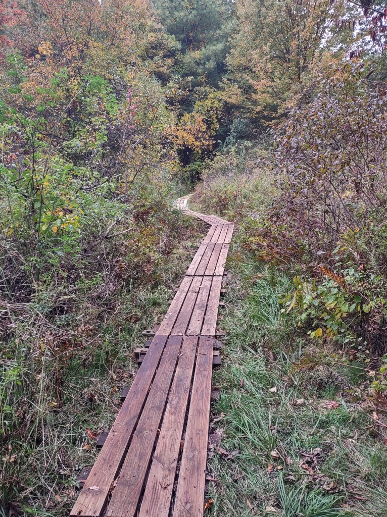
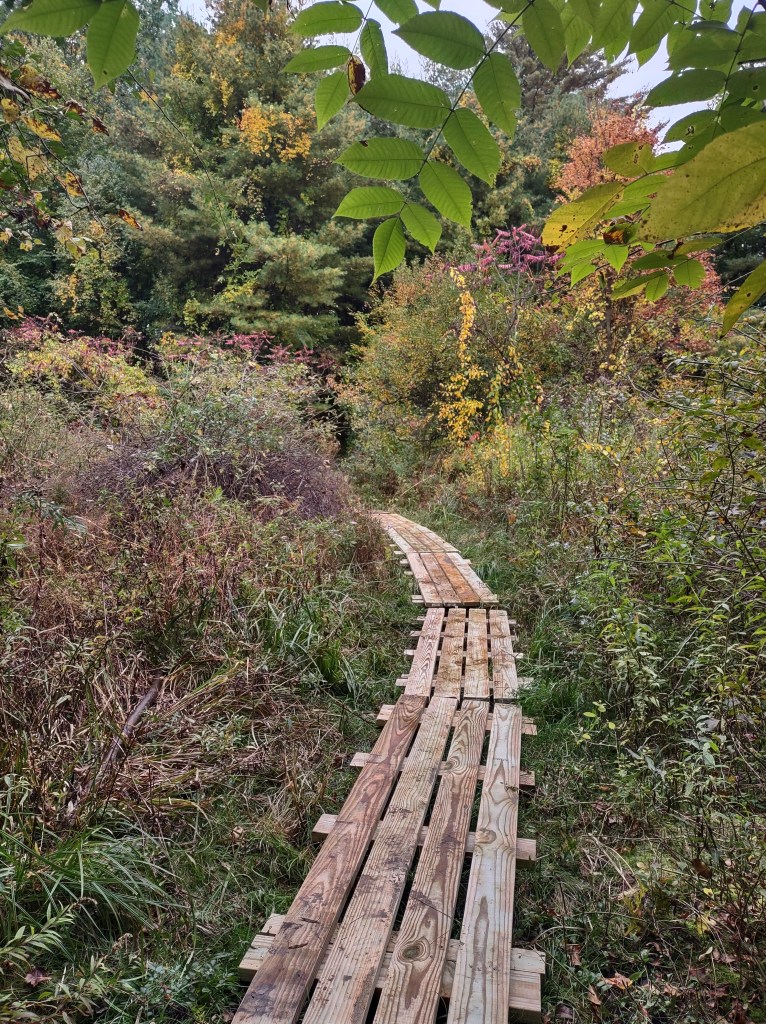
Entry spots and parking areas are noted on the map below. Walkers will find woods, marshes, and floodplain forests. An overlook bench is located off of a spur trail from the “Vista Trail.” This trail can be wet in some seasons, with roots and rustic bridges that lack handrails.
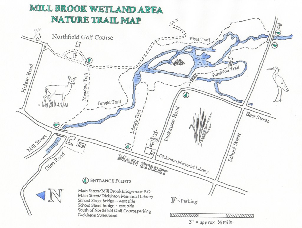
Map drawn by Annie Chappell
History
Called Cowas Brook in precolonial times, the brook served as a boundary between the Abenaki sachem Nawlet to the north and Massamet to the south.
Indigenous inhabitants sought out sources of fresh water and built seasonal homes along the brook. Northfield’s earliest European settlers arrived in 1673 and identified Mill Brook and Millers Brook as critical to the development of a village.
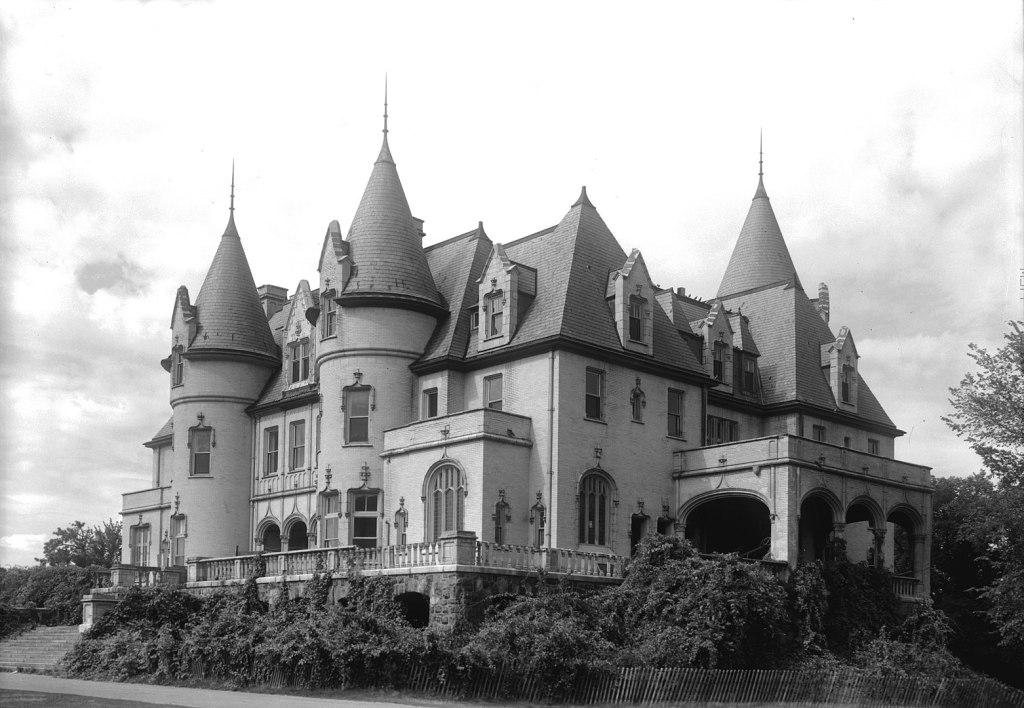
Mill Brook was so designated because it had ideal downhill stream flow from Warwick where water power could be harnessed for industry. Early maps reveal a number of early endeavors including a cider mill and a tannery along its upstream banks and a grain mill and sawmill operating from millponds near Main Street where water dropped quickly to the Connecticut River. When Francis Schell bought the property a century later, he had a whole different idea. He erected a large dam to impound the water from Mill Brook creating a large lake on which he operated a boat to entertain guests of his Chateau (photo below). The dam was destroyed during the 1936 Flood and the lake became a wetland that you see today.
History submitted by Sue Ross
Birds in the Wetlands
Wetlands provide crucial habitat for many species of birds during all seasons of the year. Birds use wetlands for breeding, nesting, rearing young, for shelter and social interactions. During seasonal migration in spring and fall, birds use wetlands as places to rest and feed.
The Mill Brook wetland hosts many birds. Walk quietly, look and listen. During spring migration, the first arrivals are Redwing Blackbirds, followed by magnificent Wood Ducks and fly catching Phoebes.
As spring progresses, Tree Swallows and Great Blue Herons arrive for the summer, and the beautiful singers: Catbirds, Rose Breasted Grosbeaks, Redstarts, Yellow Warblers, Warbling and Red Eyed Vireos.
Even during the late fall and winter, when the summer migrants have gone, winter residents take shelter in the wetland, seeking warmer temperatures and plenty of berries. You will see Robins, Bluebirds, and Song Sparrows all year round, as well as the ubiquitous Canada Goose.
Contributed by Patter Field

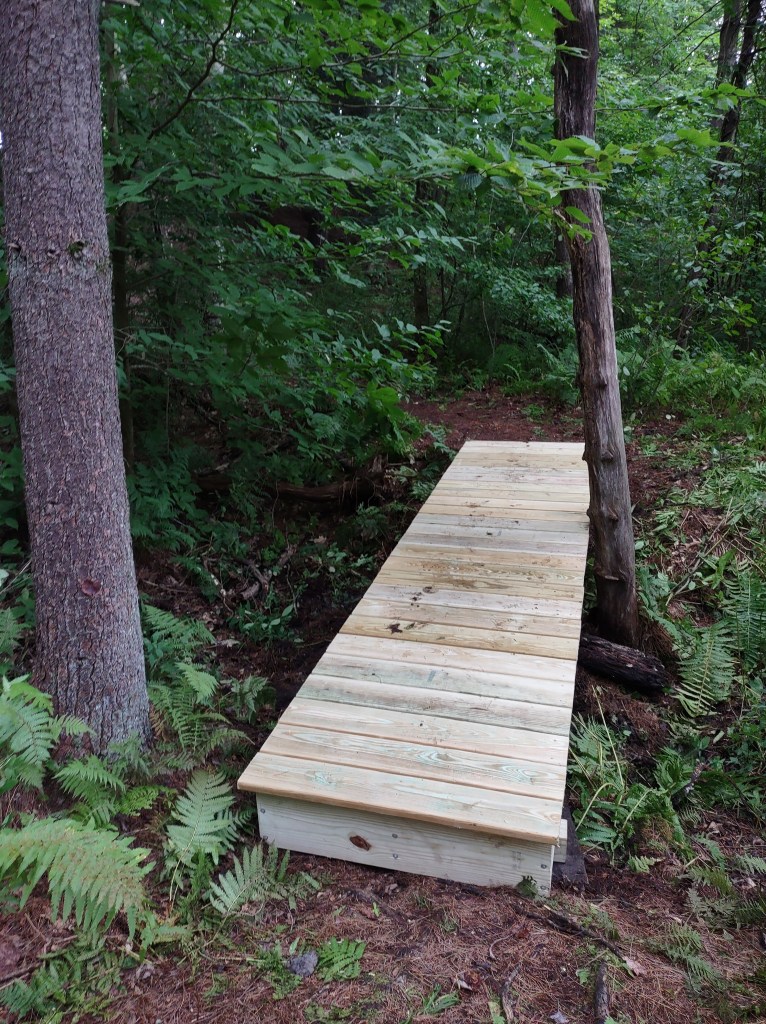
A Work in Progress
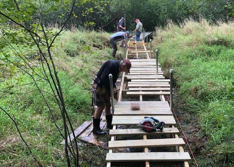
In 2021, the town voted to use some Community Preservation Fund (CPA) money to purchase materials to rebuild rotting and collapsed bridges. In the summer and fall of 2021 and into 2022, the Open Space Committee and nearly 30 volunteers worked to rebuild boardwalks, footbridges, kiosks, update signage, and remove invasive plants. The trail still has some problem areas (limbo under the sap lines on the “Meadow Trail” between the Golf Course and Main Street), but most should be passable and allow for dry feet! We hope to one day rebuild a bridge across the main stem of Mill Brook, but for now, if you want to complete the loop, you’ll need to use the sidewalk on Main Street.


Downloadable/ Printable Trifold Flier
